
7:25 in the morning at the Sesriem gate, and I was shivering.
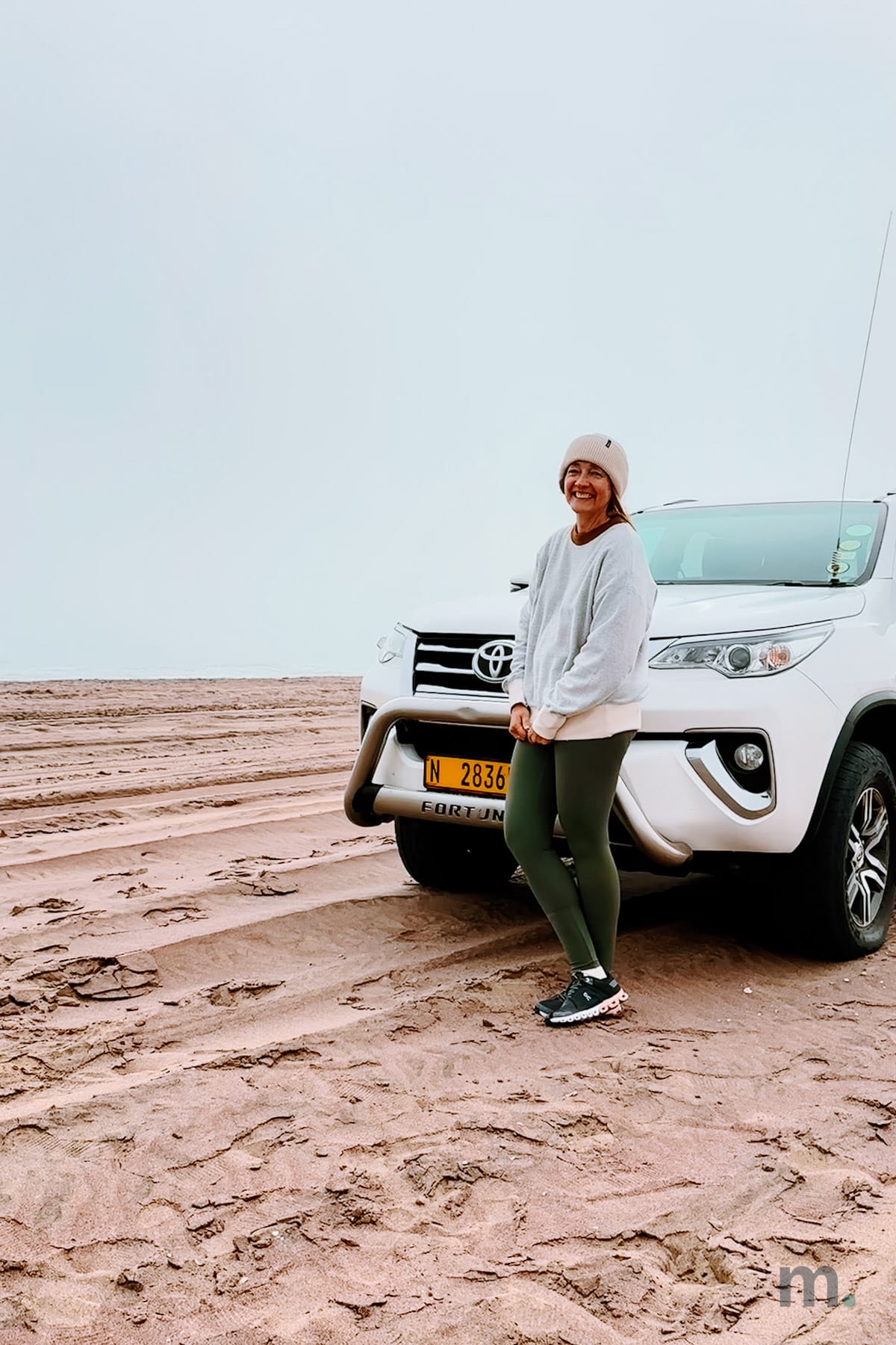
That’s not what I expected from the oldest desert on earth. Ahead of me was a line of people leaning against their cars, all in beanies and jackets, waiting for the gate to open with the sunrise. Most of the engines were running just for the heat. A few hours later, I was peeling off layers on top of a dune, with my feet buried in the sand.
That swing in temperature is the first thing you need to know if you’re thinking of going on a Namibia road trip.
I did this route as a tour leader for Leva-me, but I’m writing it here the way you would do it in a rental car, which is how most travelers do it.
When to go, and why winter wins
I went in July, the middle of the southern winter, and I’d go back at the same time of year.
The mornings are freezing and so are the nights, but everything else makes up for it. There’s little or no rain, the gravel roads hold firm, and the dry season pulls the animals around the waterholes in Etosha, making them easier to see. I didn’t take any malaria pills, but then again I didn’t see a single mosquito in these ten days. I think the cold probably helped.
But if you’re thinking of going between December and April, it’s a whole different conversation. Everything is greener and prettier, but you may find the road into Sesriem flooded and the malaria risk climbing. If you go then, make sure you schedule a travel medical consultation before you leave and count on renting a 4WD.
And bring warm clothes. I say it twice because I watched people head out on dawn game drives wearing no more than a T-shirt and a light jacket and looking like they were in full-on suffering, with the whole morning still ahead of them. A beanie and a pair of gloves take up no space in your bag, and they will save your day.
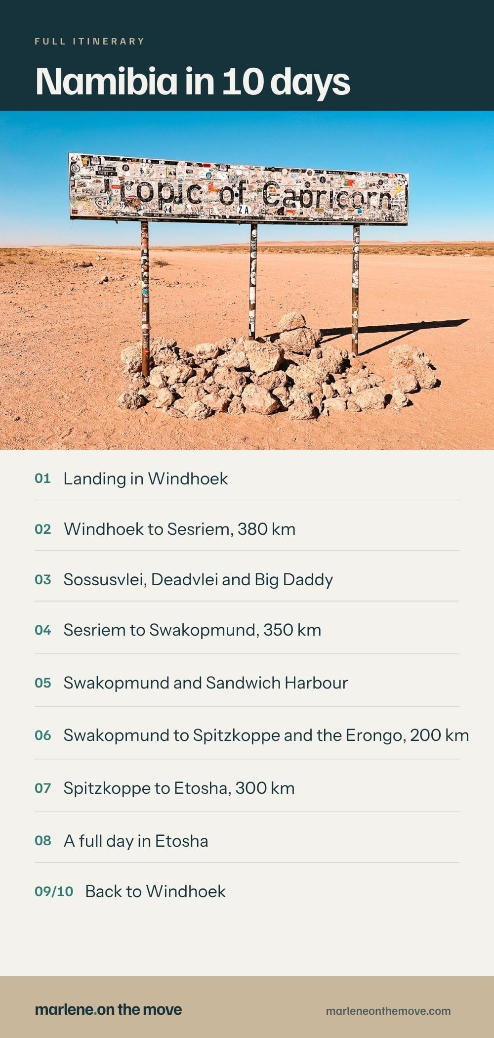
Namibia: The route, day by day
It’s about 2,200 km, or 1,370 miles. The distances are long, and they tire you out far more than the numbers suggest when you are planning this road trip at home with Google Maps open in front of you. A must-do thing is stopping every couple of hours to stretch your legs, even when there’s nothing much to look at. Do it. You’ll thank yourself by day three.
Day 1 | Landing in Windhoek
Flights from the US come in through Frankfurt, Doha, Addis Ababa or Johannesburg, and you will land in the morning either way. Hosea Kutako airport is 40 km from the city, about 45 minutes.
Before you leave the terminal, sort out a SIM card. More on that later.
This is a day to arrive, relax, and sleep. There’s no point squeezing a program out of it. I stayed at the Windhoek Country Club Resort, which was comfortable but not that interesting. I spent the whole afternoon by the pool.
Day 2 | Windhoek to Sesriem, 380 km
Get ready to leave early, because you have a six-hour drive ahead of you, including stops, and the last part is on a gravel road.
You’ll pass through Rehoboth about an hour and a half after leaving, and that’s where you’ll find the last ATM before Sesriem. If you didn’t withdraw cash in Windhoek, do so here. Many places accept credit cards, but it’s easier to pay for parking fees, the shuttle, and small expenses if you have Namibian dollars.
The drop from the highlands into the Namib happens without much warning. The scrub thins out, the horizon opens, and at some point you notice there’s nothing around you at all.
It was on this road that I learned our driver’s story. Chris didn’t drive tourists full time, there was no living in it: he was a police officer, and when there was no shift and no tourists to take around the country, he went and painted houses. He told me this without any drama, the way you would list the things you have to get through in a normal week, and I spent the rest of the trip thinking about it every time I looked at a country that at first glance seems to be only landscape.
I got to Desert Homestead Lodge at half past three, with time to do nothing until dinner.
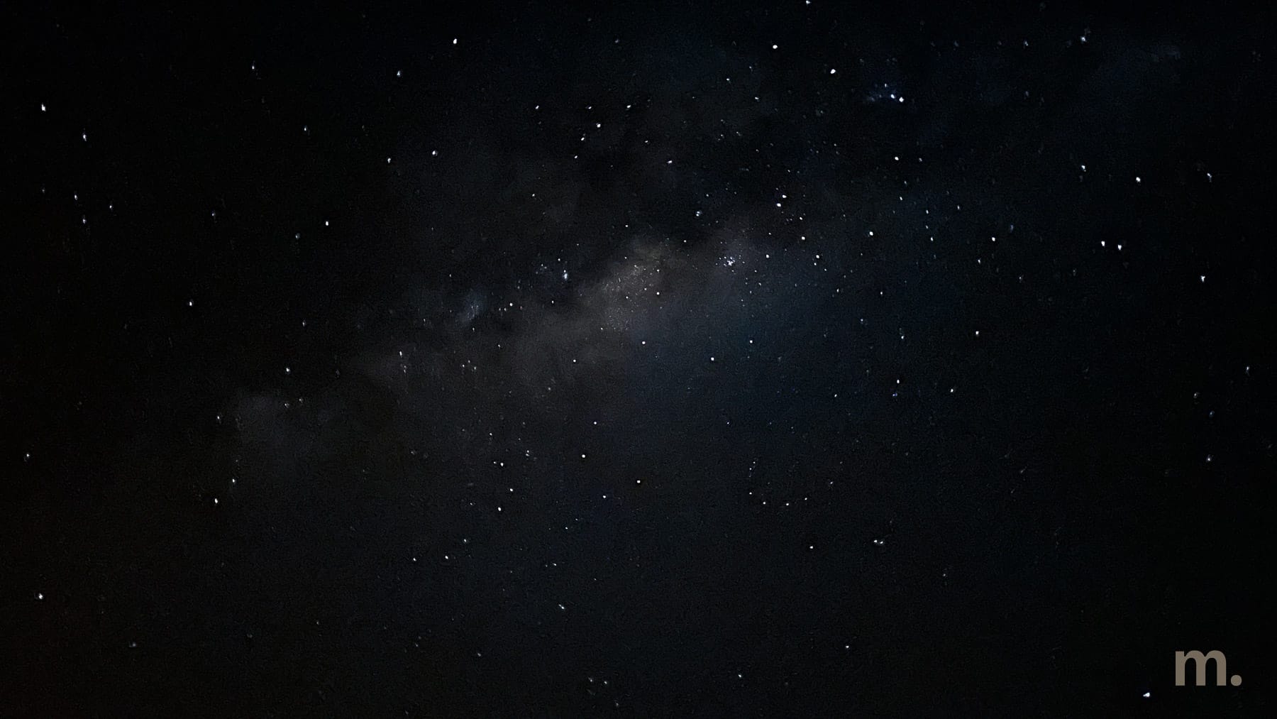
That night, I looked up for the first time and saw the starriest sky I’d ever seen. I took a picture of the Milky Way with my cell phone, and even with the lodge lights still on beside me, I saw a magical world above my head. This would become my ritual every night I spent in Namibia.
Day 3 | Sossusvlei, Deadvlei and Big Daddy
This is a big day, and it starts at sunrise.
The Sesriem gate opens at sunrise and closes at sunset. In July, that means around 7:20, and there’s no point trying to get in earlier unless you are staying inside the park. We were at the gate at 7:15.
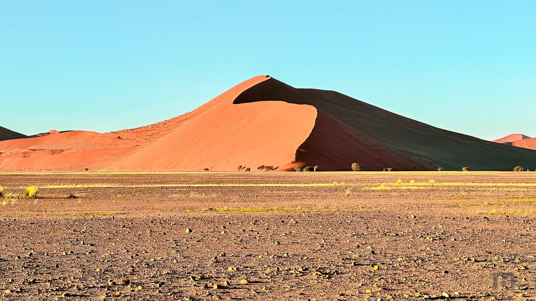
When we enter, the temptation is to speed all the way to Deadvlei. Don’t. The first few kilometers past the gate, with the sun still low and hitting the dunes side-on, splitting every crest into two halves, one brick red and the other almost black, are half the reason you got up at that hour. We stopped several times along the way, and by twenty past eight we were at Dune 45 under that particular blue that only happens where there’s not a drop of moisture in the air.
The last 5 km into Sossusvlei are deep sand and need a 4WD. There’s a shuttle that runs that stretch from the 2WD parking lot. It costs NAD 200 (about $12) per adult, and it solves the problem for anyone in a normal car. That’s what we did.
Once you arrive, you can head straight to Deadvlei or climb Big Daddy, one of the largest dunes in Sossusvlei. That’s what I did. The climb is tough and not for those with limited mobility, and the best advice I can give you is to go at your own pace, along the edge of the dune, where the sand has already been trodden by those who passed before you. The time it takes to climb depends on your fitness level, so don’t get hung up on numbers.
I was a bit nervous about the descent because the slope is high and very steep. As it turned out, that was the easy part. Halfway down (yes, I didn’t climb all the way to the top because that would have taken a few hours), I took a trail that was already clear and just sank my feet into the sand, almost running, until I reached the dead trees at the bottom. Of course, as soon as I got to the bottom, the first thing I did was shake out the “kilos” of sand from my shoes.
As for the incredible dead trees, you must not touch them. A person’s weight damages them, and there are severe fines for anyone who does so. There are reports of visitors who sat on them or even hung from them, breaking branches, just to take a photo. Sometimes I really don’t know what goes on in people’s minds.
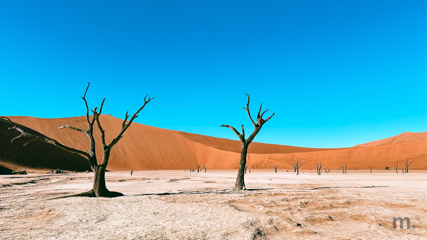
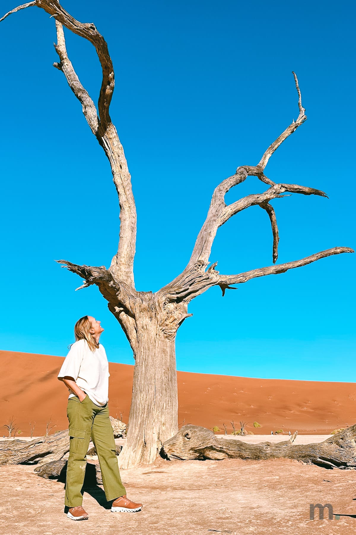
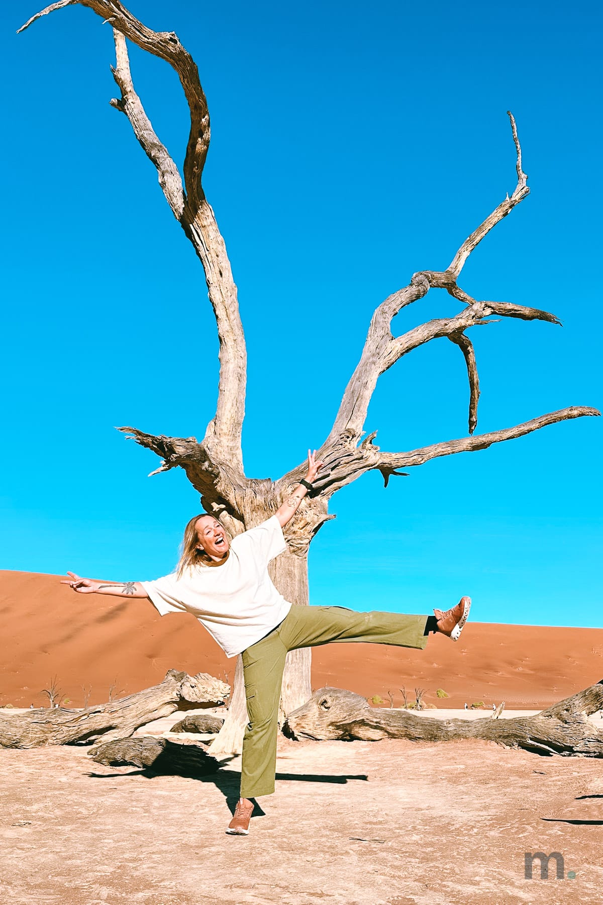
When we arrived at Deadvlei, the sun wasn’t yet at its highest point, and that’s another advantage of visiting in the winter. In the summer, at the same time of day, it could already be a problem.
After Deadvlei, we went to the Sesriem Gorge, carved by the Tsauchab River through deposits that are 15 million years old. It reaches a depth of 30 meters in some places, and you walk through it on uneven rock, which can be difficult for those with limited mobility. After the open desert of the morning, entering that narrow gorge completely changes your perspective of the landscape.
Day 4 | Sesriem to Swakopmund, 350 km
This is a day that can take seven hours on the road, but with some extraordinary stops along the way.
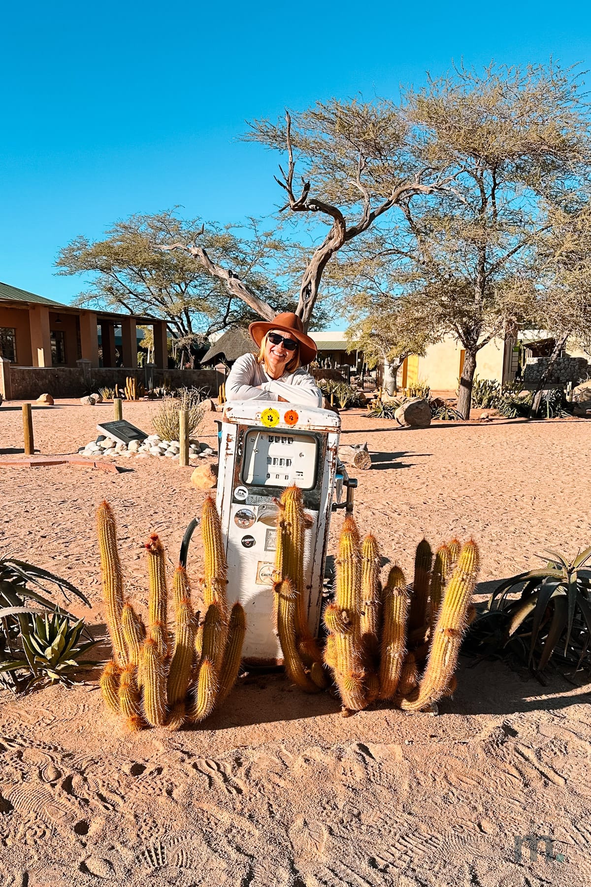
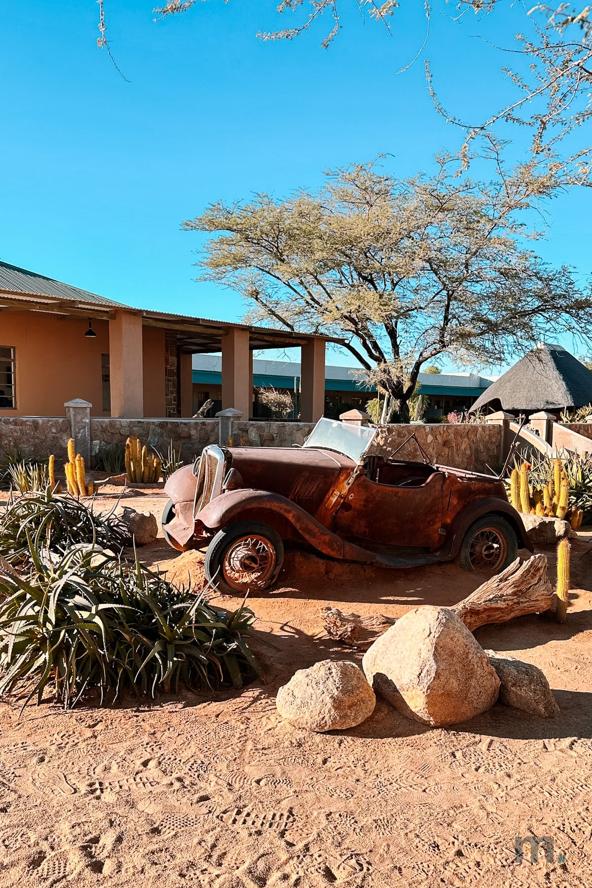
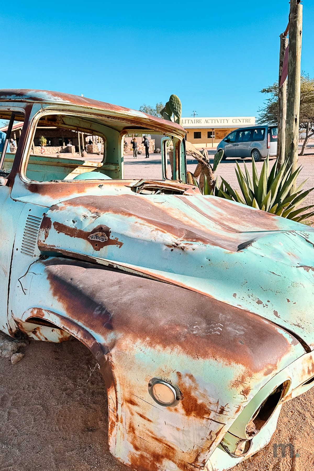
The first is Solitaire, about an hour and a half out. It’s a few buildings, a bakery, and a workshop in the middle of nothing, but instead of towing away the cars that broke down there, someone decided to leave them rusting in the sand, year after year, until the place turned into what it’s now and started showing up on travel guides because of it.
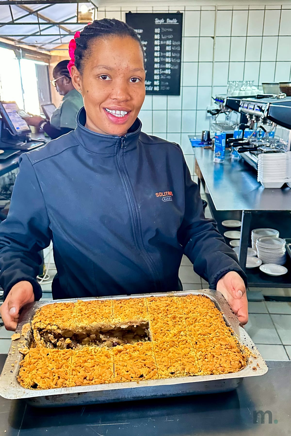
There’s a gas station (one of the main places to refuel along the way) with cacti planted in front of it. It makes no sense at all. That, and the apple pie, considered the best in Namibia. And let me tell you: it deserves all the praise it gets.
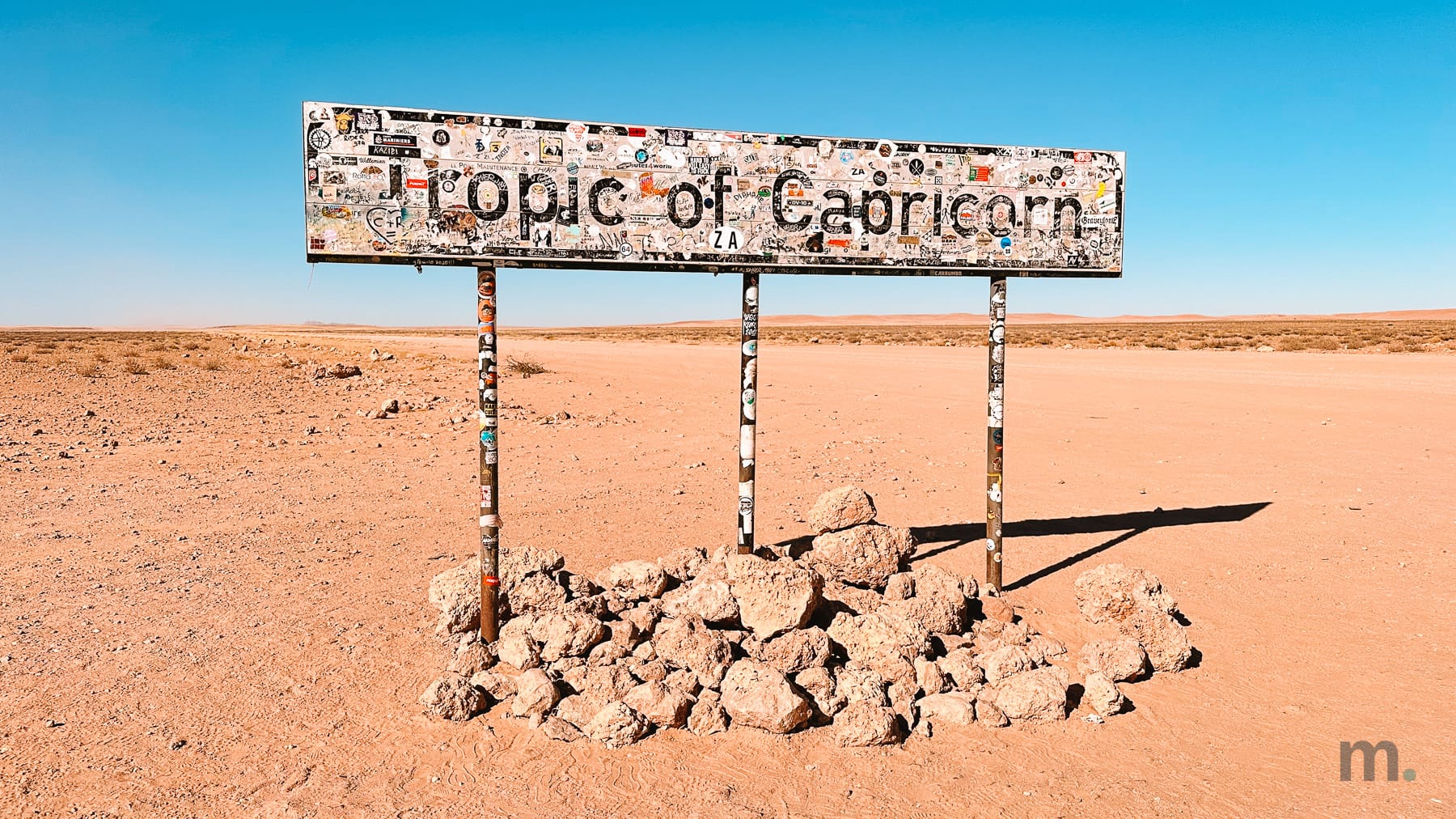
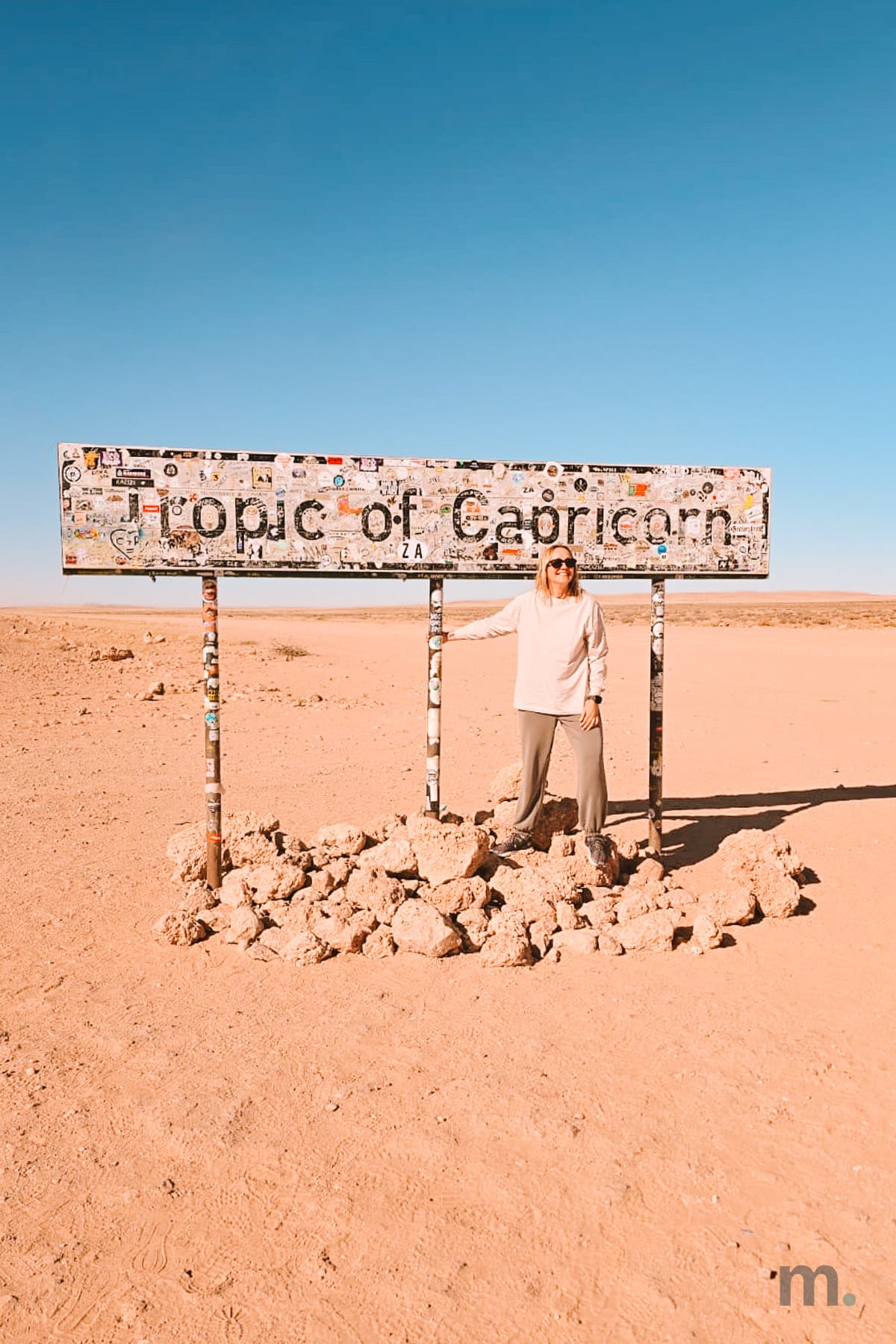
An hour after Solitaire, the road crosses the Tropic of Capricorn, marked by a sign in the middle of nowhere. It stands on three metal posts, a pile of light-colored stones leaning against the base, and nothing else as far as the eye can see. But it’s covered with stickers from top to bottom. Layer upon layer left by travelers who passed through and wanted to leave their mark.
Then comes the Kuiseb canyon, which is what stops the dunes from marching any further north. On one side of the road, sand. On the other, gravel. You can see the line between them with your own eyes.
We drove through Walvis Bay in the middle of the afternoon, with thousands of flamingos out on the lagoon, and only got into Swakopmund around six. I stayed at the Strand Hotel, right on the beach.
Day 5 | Swakopmund and Sandwich Harbour
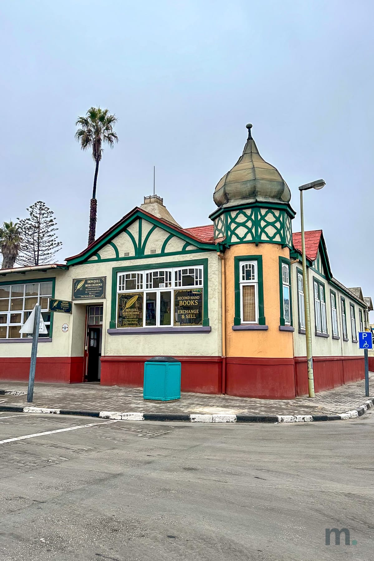
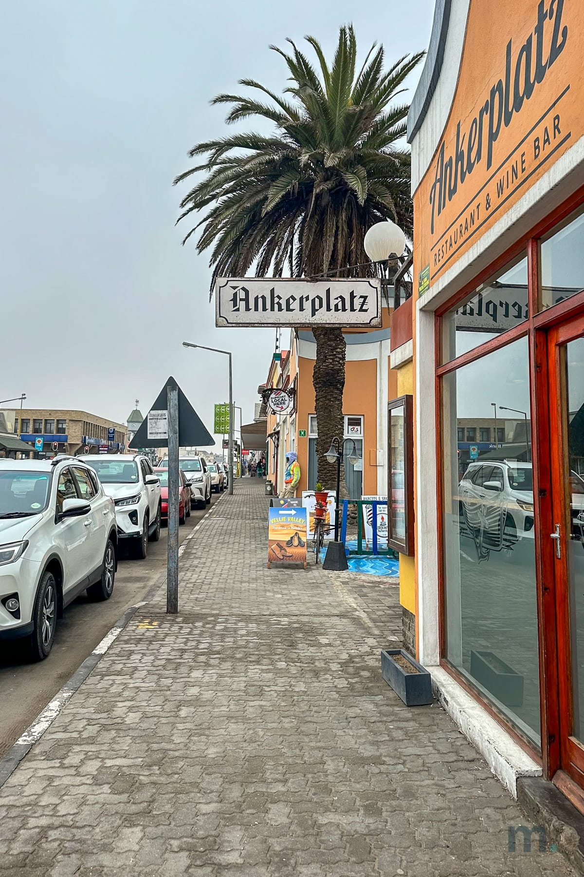
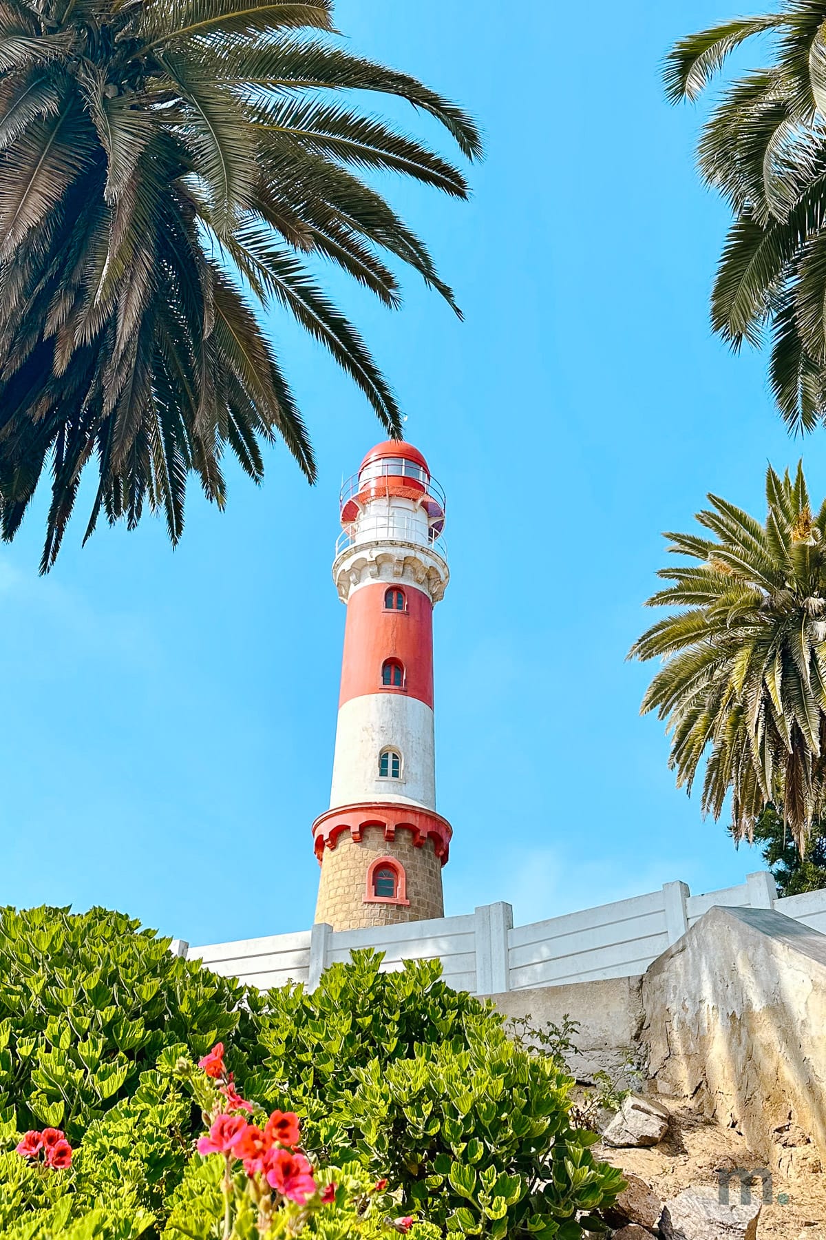
In the morning, I walked around town, founded in 1892 and still looking German to an almost absurd degree. Bakeries, bookstores, German street names, and colonial architecture pressed up against the cold Atlantic.
Next to the hotel, there was a craft market, and that’s where the morning soured a bit. Since there were not many tourists around, the sellers came at me hard. I couldn’t stop to look at a piece on display without immediately being surrounded by five or six VERY pushy people. I had to be very patient and even speak louder than they did, which isn’t like me at all.
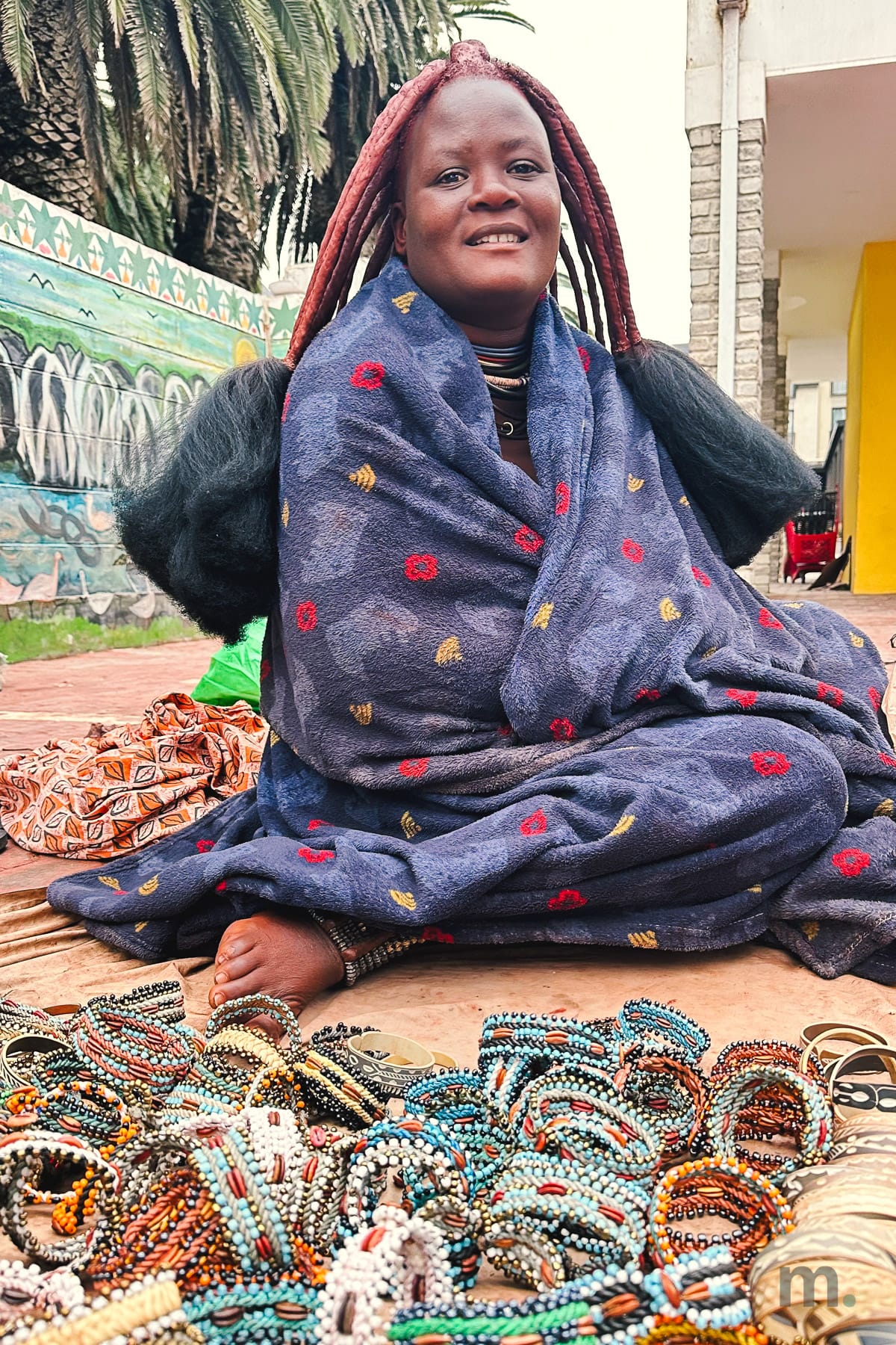
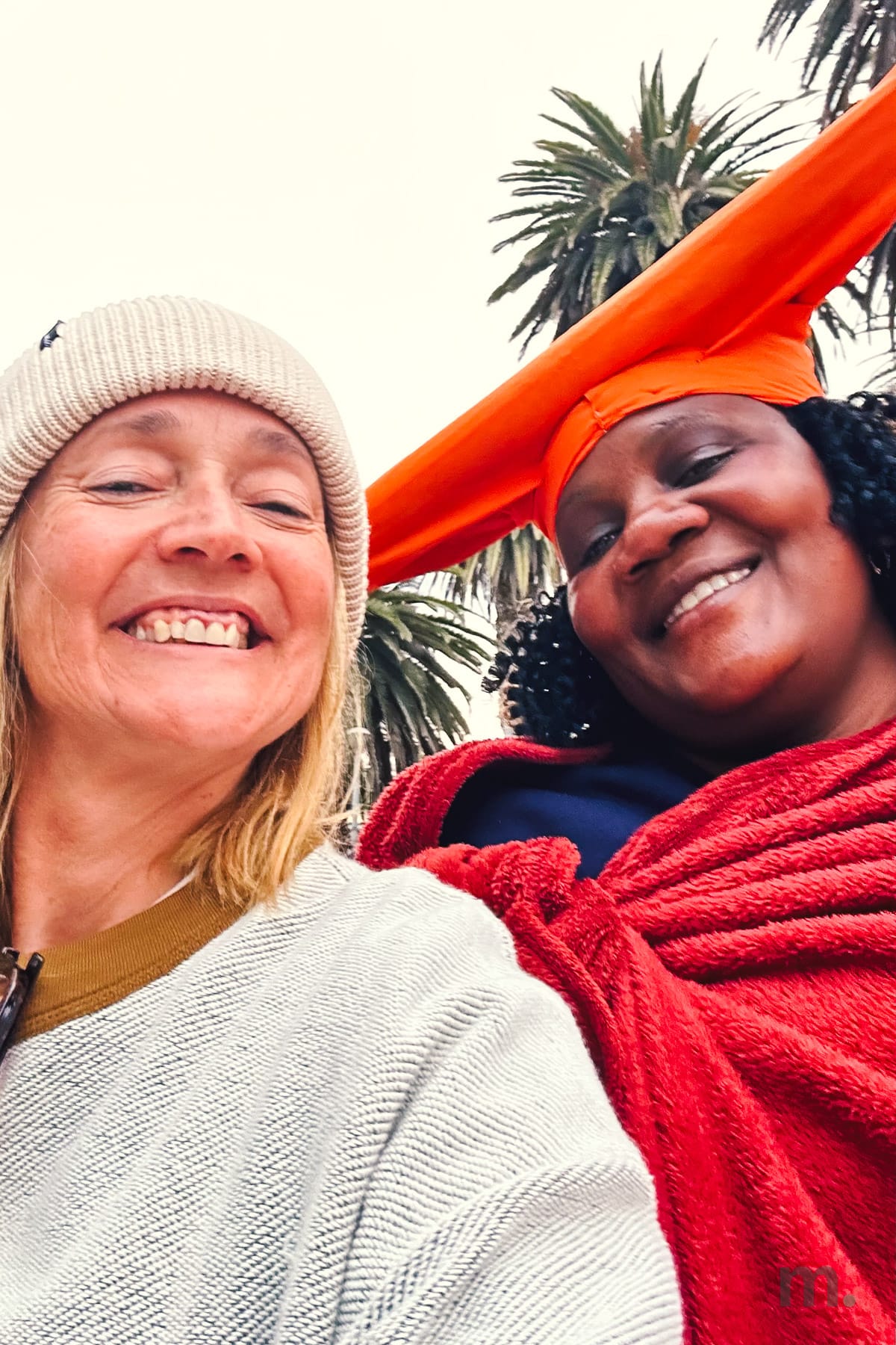
It was also there that I saw the women of the Himba and Herero peoples. They were selling beaded bracelets, dressed in traditional attire: the Himba, with their hair covered in red ochre paste, and the Herero, wearing their traditional hats.
It was cold, so almost all of them were covered up, but as soon as someone asked to take a picture—and they only allowed it if you bought something first—the Himba women would quickly undress, baring their breasts, strike a pose, and cover themselves up again as soon as the camera was lowered.
I believe there are Himba and Herero people living their lives somewhere else in the country. Those women were there for tourism and made no pretense otherwise.
In the afternoon, I went on a Sandwich Harbor tour, and it’s the one thing I wouldn’t cut from this itinerary. You go by 4WD with a local operator. There’s no other way, and it starts at NAD 3,095 (about $192) per person for a half day.
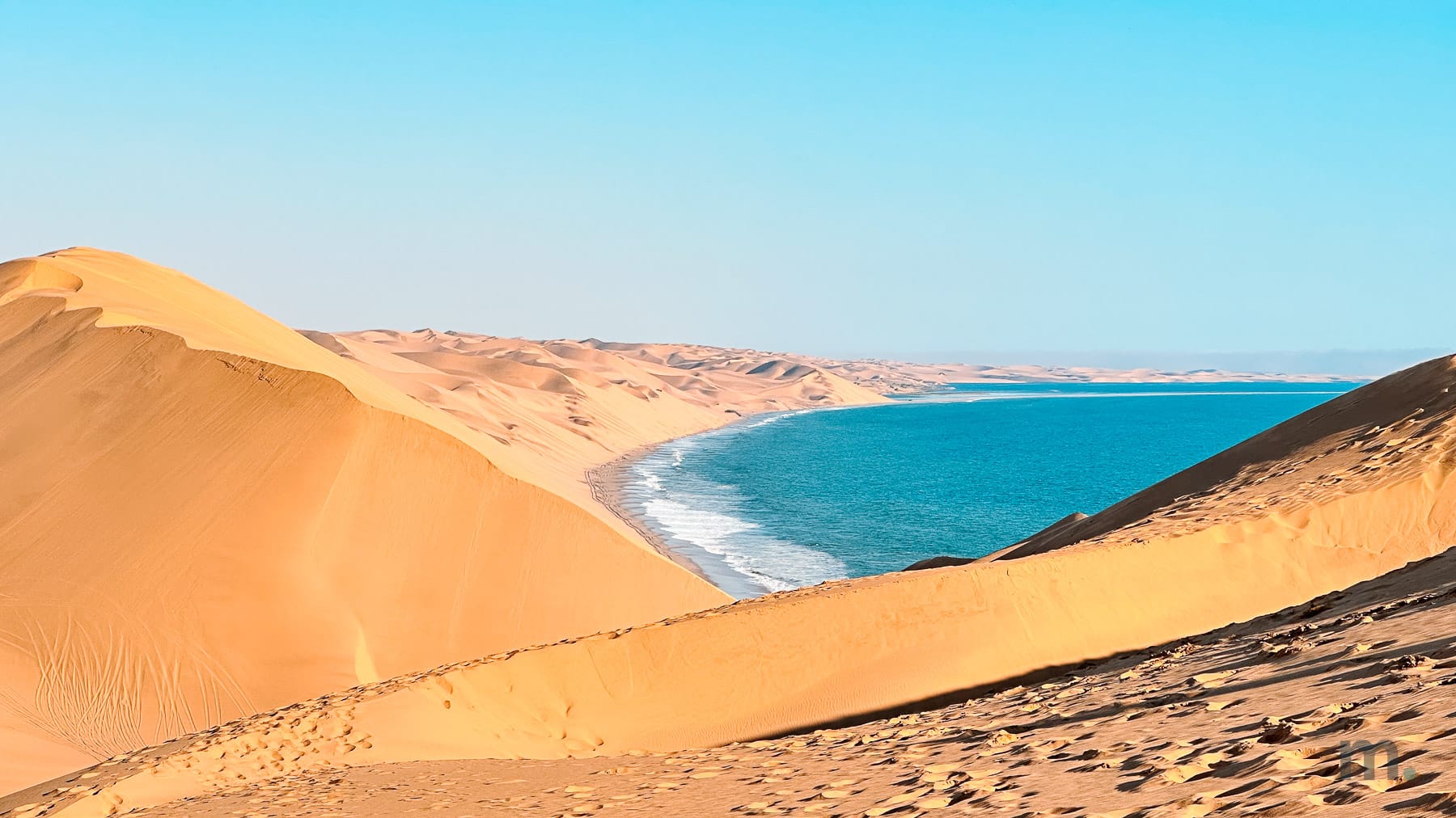
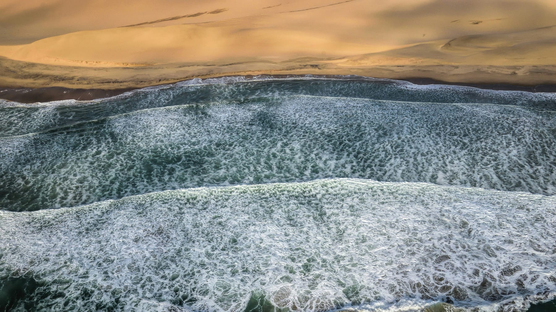
These are the oldest dunes in the world and they run all the way to the sea. That’s the part that’s hard to explain to anyone who hasn’t seen it: the dune doesn’t slow down or break apart into a beach the way every dune you’ve ever seen does. It just keeps going down to the water, walks into it, and ends.
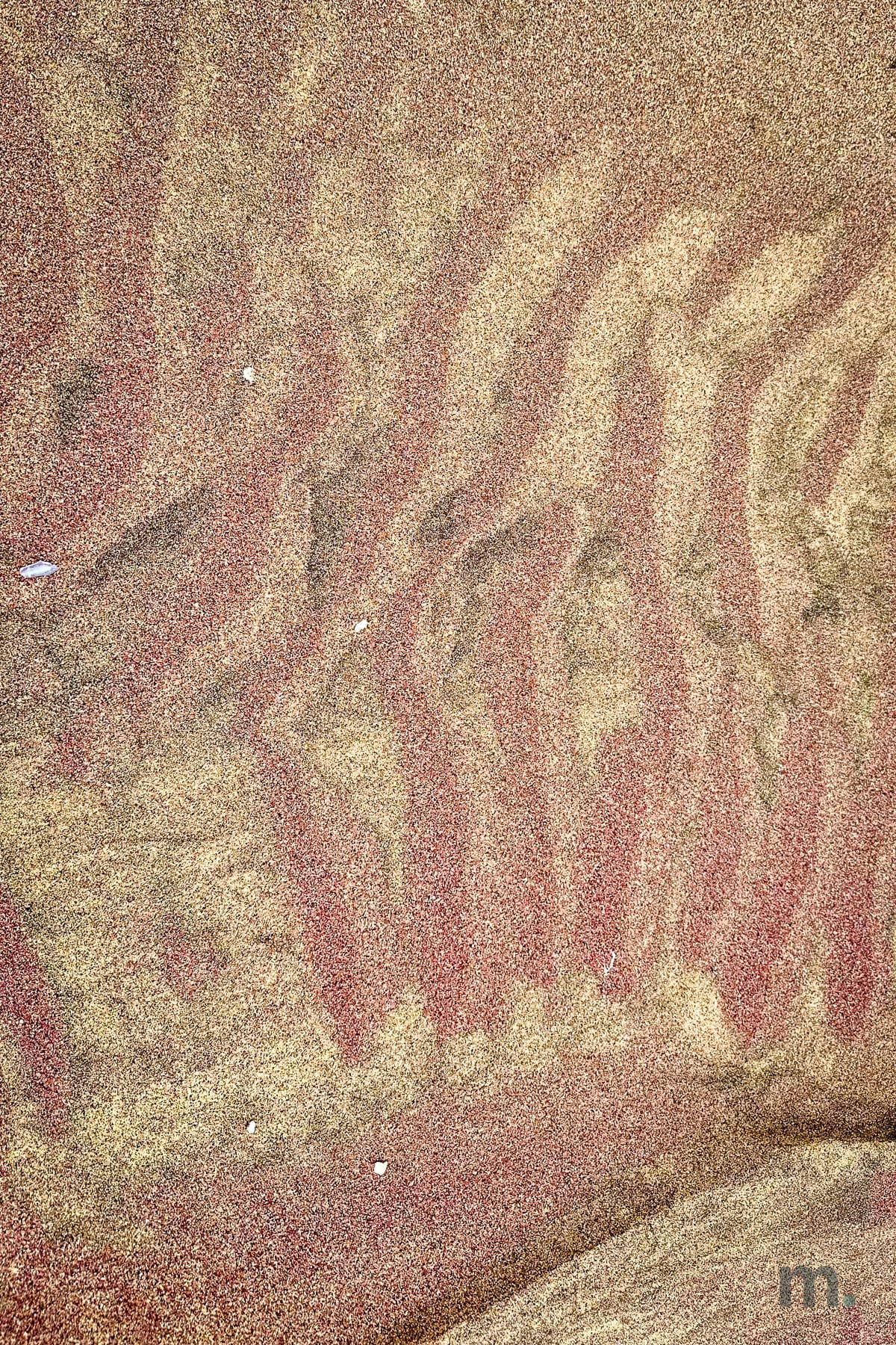
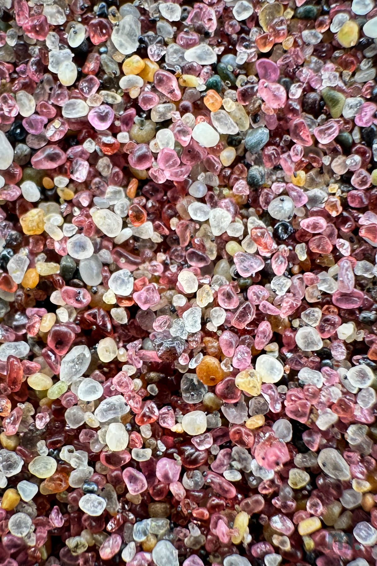
Following the water’s edge, we stopped to take close-up photos of the sand, which is pink and white there. When we zoomed in, we saw how the grains of garnet and quartz—smaller than pinheads—almost looked like gemstones. It was as if we’d discovered a treasure, and we stayed crouched there for several minutes.
Then it was time to head up the dunes—vertical, immense, and immersive—and let the adrenaline take over.
Day 6 | Swakopmund to Spitzkoppe and the Erongo, 200 km
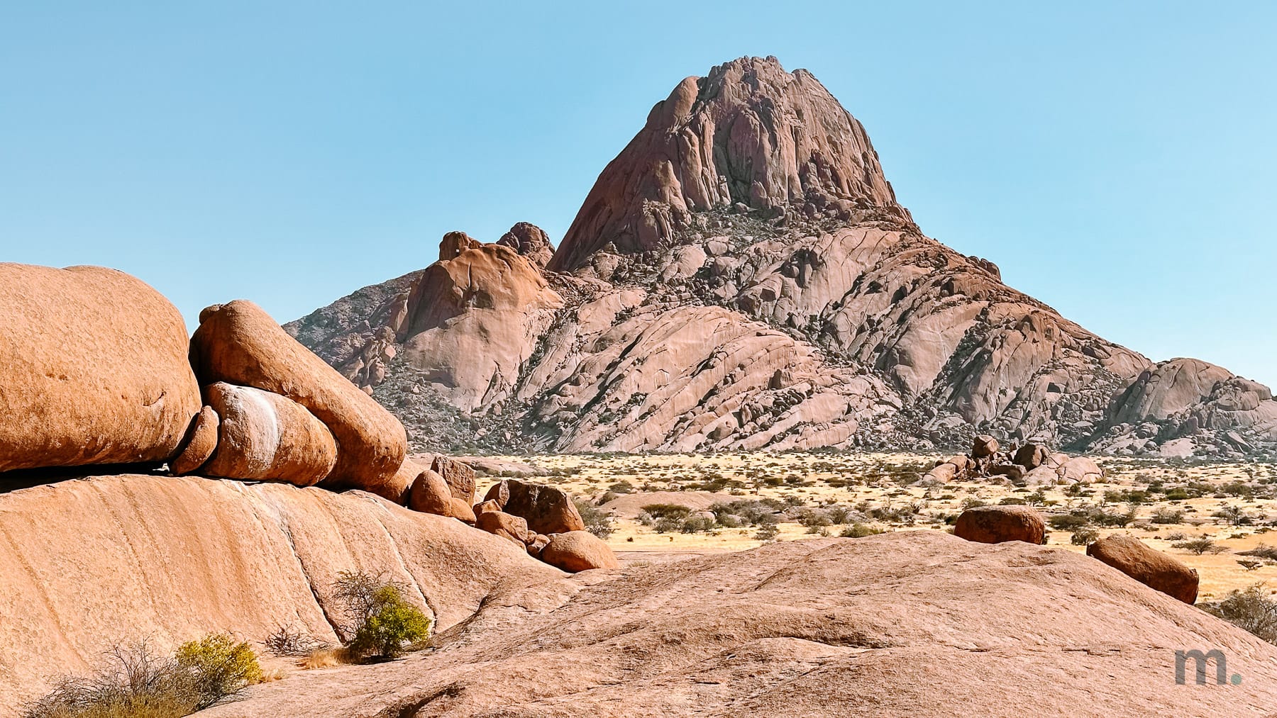
Spitzkoppe is a granite massif that stands 1,728 meters above the plain, on its own, with nothing around it to explain why. They call it the Matterhorn of Namibia and from a distance you can see the point.
I’ll be honest: it wasn’t my favorite stop on the trip. The rock formations are impressive, and I completely understand that it’s an extraordinary place for rock climbers, but for me, it fell a little short compared to the rest. Maybe it’s because I didn’t spend much time there. Who knows. I’m still not sure.
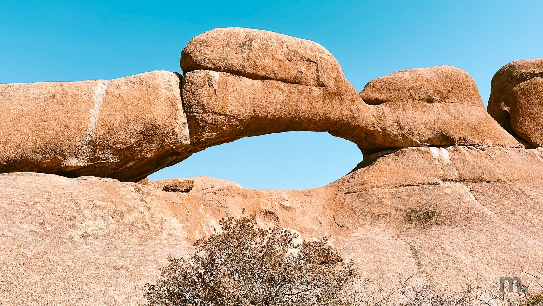
So why not sleep there? The Spitzkoppe community campsite charges NAD 300 (about $19) per person per night, and everyone who has slept under that stone arch says that was the best part. I didn’t sleep there. I went on to Ai Aiba Rock Painting Lodge, in the Erongo about 50 km away, and did a guided walk around it late in the day.
Day 7 | Spitzkoppe to Etosha, 300 km
You go through Outjo, which is where you fuel up and buy whatever’s missing, and enter the park at Andersson Gate in the south.
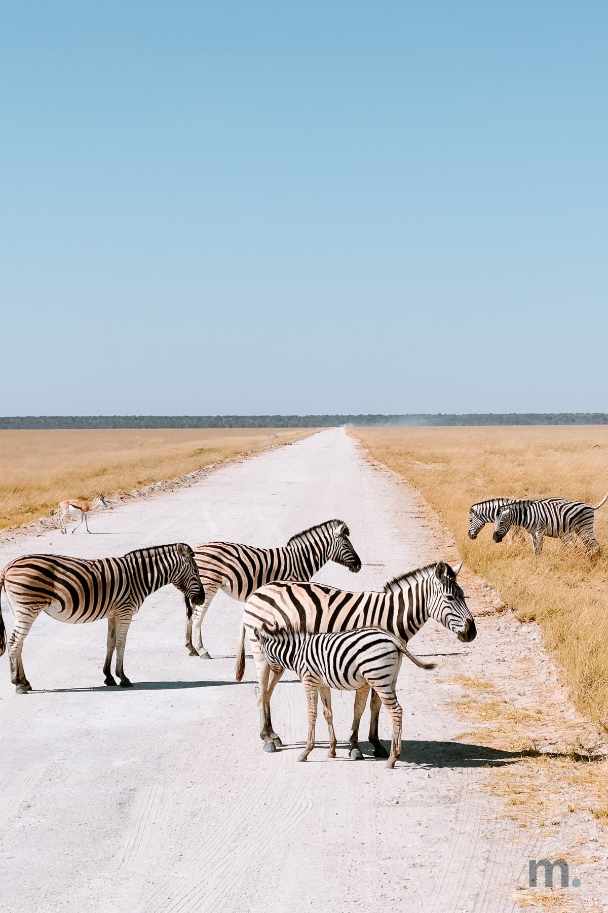
Here, something happened that was not planned and turned out to be the best part of the day: instead of driving straight to the lodge, we crossed the Etosha park from west to east, entering around two in the afternoon near Okaukuejo and reaching Namutoni only at half past five, with the sun already dropping.
Three and a half hours of driving inside Etosha. The white pan opens up on your left all the way to the horizon, flat and empty in a way that makes your eyes ache, and after a while you stop being able to say where the ground ends and the sky starts, because the heat lifts a shimmering line between the two and then erases it.
By now, you’ll be—just as I was—completely enchanted by the drive through Etosha, and the animals will already be starting to appear, but keep an eye on the clock. Here, too, the gates open at sunrise and close at sunset, and there’s zero tolerance if you don’t stick to this schedule.
If you’re staying inside the park, you must be back at your lodge before closing time, and if you’re staying outside the park, you must leave by that time. They take this very seriously.
I slept at Mokuti Lodge, just outside Von Lindequist Gate.
Day 8 | A full day in Etosha
We left at 7:20 in the morning and came back at six, with one stop at a picnic site for lunch and nothing else, because once you are inside, every hour you spend out of the car is an hour you’re not seeing an animal. It was the day with the most photographs of the whole trip. It was also the coldest day.
The morning game drive, in an open vehicle, is brutal. It’s not light-jacket cold, it’s beanie-and-gloves cold, with the wind hitting your face at 50 km/h while the sun is still only halfway up and nobody in the car says anything because opening your mouth lets more cold in.
Then it warms up, and by noon you’re in short sleeves. So, wear layers that you can take off as the morning goes by.
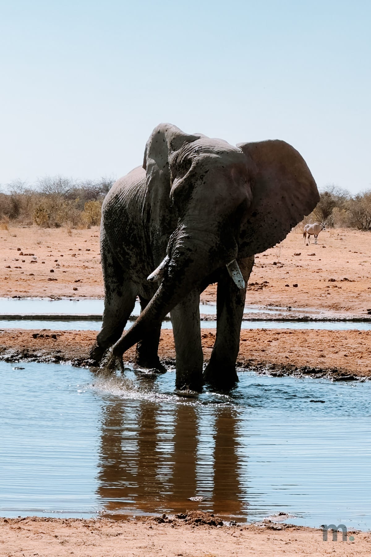
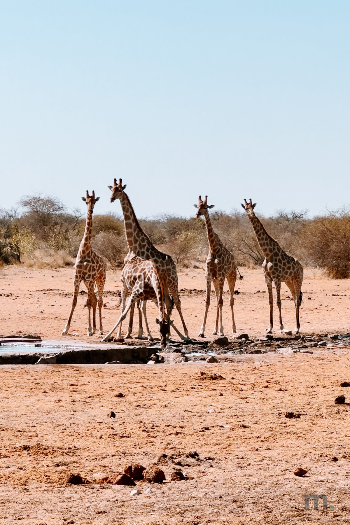
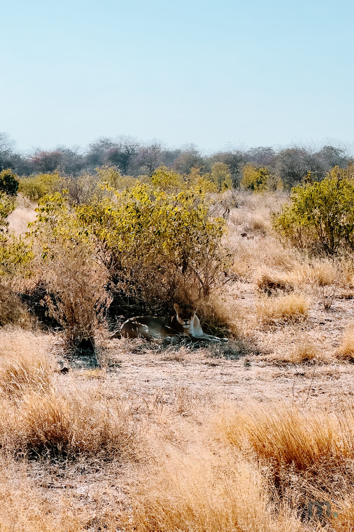
Shortly after we entered the park, there was already an elephant standing right in front of us, all alone, with the sun still orange and our own shadow stretched out on the ground in front of it. Next came several watering holes, with wildebeests and springboks drinking, completely oblivious to us. I had the luck of a lifetime: I saw a leopard, one of the hardest big cats to spot in Africa. Many people go on ten safaris without ever seeing one. And, after searching for a long time, I even saw a lioness!
If you’re self-driving, the park roads are packed gravel, and a normal car handles them fine. Just check the access to your lodge if you are staying outside the park.
Days 9 and 10 | Back to Windhoek
Etosha to Windhoek is around 480 km, which is a full day on the road. If you would rather break it up, Otjiwarongo sits about halfway and has lodges with their own reserves where you can do a late-afternoon game drive. That’s what we did, at Otjiwa Lodge.
If you go straight through, leave early and plan several stops along the way.
Driving in Namibia: what you actually need to know
Do you need a 4WD in Namibia? Everyone will tell you that you do. But, in my opinion, you don’t need one for this itinerary.
Windhoek, Sesriem, Swakopmund, Spitzkoppe and the interior roads of Etosha all go fine in a normal car with decent ground clearance. The only stretch that needs four-wheel drive is the last 5 km into Sossusvlei, and for that there’s the shuttle at NAD 200.
Plenty of people rent a kitted-out 4WD, rooftop tent and all, at three or four times the price of a regular car, because they read somewhere that it was mandatory and nobody bothered to tell them that it depends entirely on the route they’re driving and the time of year they’re going. On this route, in July, it isn’t.
Of course, there are exceptions, and the rainy season—from December through April—is one of them, especially on the road to Sesriem, which can flood. In that case, don’t mind me.
Other things you have to take into consideration:
Namibia drives on the left. If you are coming from the US, that’s the single biggest adjustment, and it bites hardest at junctions and roundabouts on empty roads where there’s no traffic to copy. Say it out loud for the first day.
Your license is enough. For stays under 90 days you don’t need an International Driving Permit as long as your license is in English, which covers US and UK drivers.
Speed is what kills people here, not the roads. Sealed roads are 120 km/h and gravel is 100, but rental companies often cap you at 80 on gravel and they’re right to. Loose gravel plus speed plus a sudden correction is how rollovers happen, and it’s the most common serious accident in the country.
Don’t drive at night. No street lighting, animals on the road, and nowhere to get help.
The rest is simple: enough ground clearance for gravel, a spare tire in good condition, and the habit of filling up every time you pass a gas station, even at half a tank.
Visa, insurance and health
Since April 2025, most Western visitors need a visa to enter Namibia, and that includes US and Portuguese passport holders. You can do it on arrival at the airport, or ahead of time as an e-visa. It costs NAD 1,600, about $99.
You’ll need a passport valid for six more months with three blank pages, the completed form, proof of accommodation and itinerary, and proof of travel insurance. That last one is what catches people out, because it’s not optional: no insurance, no entry. I always travel with Heymondo travel insurance, and here it stopped being a matter of good sense and became a condition of getting in.
On malaria: the risk in Etosha is low between May and October, so I didn’t take any preventive medication, and everything went well. From November through April, it’s a different story, and antimalarial medication is recommended. No matter when you go, be sure to schedule a travel medicine consultation before you leave, because every case is different. It’s better to have one more consultation where you’re told you don’t need anything than to go without knowing for sure.
Official figures, August 2026, at NAD 1 = $0.062. Flights, car rental and lodging swing too much to give you an honest number.
The three things missing from that box are the three that change the most: what you pay to get there, what you pay for the car, and where you choose to sleep. A US–Windhoek return swings from the high hundreds to well over two thousand depending on the routing and how early you book. Compare on Skyscanner, and do the same on DiscoverCars and Booking for the actual dates you’re going.
Internet: skip the eSIM
Here’s some advice that goes against what I usually say.
In Namibia an eSIM is not the answer. None of the services I work with cover the country, and I’m not going to tell you to buy something that will not work when you get there. What you do instead is buy a local SIM at the airport.
Look for the MTC counter—it’s the country’s leading carrier. There’s one in the arrivals area, next to the baggage carousels, and another outside, before you leave the building. Choose the second one with the shorter line. The process is easy, and you’ll have coverage for the entire trip. Just don’t be surprised if you pass through areas with no cell service at all. But who needs the internet when you have those views?
Best season: April to September, peaking in September and October, when the southwest swells arrive with real size.
Level: very advanced. This is not a spot for surfers with little experience, much less beginners.
Main spots: Skeleton Bay, near Walvis Bay, is the name that matters. It’s one of the longest left-handers on earth, a sand-bottom wave that runs for kilometers and only works on a very specific combination of swell and wind.
Personal notes: This was a work trip, so I didn’t surf. But I can tell you that the water there comes from the Benguela Current, hovers around 14 degrees, and you really need a full wetsuit even in the summer. Skeleton Bay is a remote, uninhabited place, and anyone who goes there has to bring everything with them. If your goal is to surf in Namibia, that’s a different trip from this one and deserves its own planning.
Data confirmed in July 2026.
I came back from Namibia with 690 photos (not counting the videos) and one thing left to do.
I went on a safari in South Africa before this one. Between the two, I saw a lioness, a leopard, elephants just a few meters away, and a rhino… but I’m still missing the lion. The male, with his imposing mane—the one that appears in every photo anyone has ever seen of Africa—and whom I, after two safaris in two different countries, still haven’t seen in person.
Any excuse is a good one to return to Namibia. This will be mine.
And you: would you like to visit Namibia? Have you been there before? What attracts you most about this country? Share your thoughts in the comments section.
The tools I use on my own trips, with the conditions I managed to get for my readers. If you book through them, the blog pays for itself — and it costs you nothing extra.
The eSIM I am an ambassador for, powered by NOS. 10% off with the code at checkout.
Affiliate links and my own codes. Only tools I actually use.